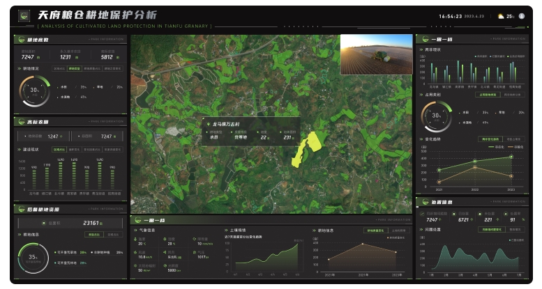
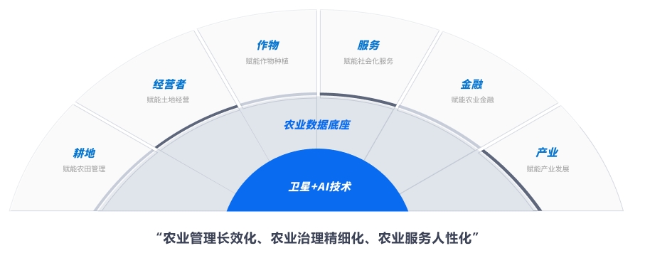
In response to the national policy call to hold the farmland red line, protect the Chengdu Plain as a grain-producing heartland, and keep a firm grip on grain production, and to build a higher-level “Tianfu Granary” in the new era, Huantian Wisdom has used imagery from its own Huantian Constellation to build an agricultural big-data foundation. The project empowers five operational cores — farmland, operators, crops, finance and services — promotes lasting agricultural management, finer-grained agricultural governance and more people-centred agricultural services, and aims to create a demonstration benchmark for digital agriculture.
1. High-frequency satellite monitoring of grain planting is used to extract planted area quickly and accurately, hold the farmland red line across the whole area, and detect and stop conversion of farmland to non-grain or non-agricultural use.
2. A space–air–ground sensing and monitoring system tracks grain crops dynamically through the full phenological cycle, collects and compiles indicators on seedling condition, air temperature and humidity and soil moisture, analyses growth in the round and estimates grain yield.
3. Disaster prevention, mitigation, warning and assessment: satellite imagery is combined with meteorological data to monitor and assess drought, flood, low temperature and other disasters, including their extent, severity and duration, providing a scientific basis for decision-making. Pest and disease risk is also monitored in time so that prevention and intervention can begin early.
4. Farm-machinery management: BeiDou plus remote sensing is used to collect information on all farm machinery and related operations, and to manage and analyse it in a targeted way, including basic information, real-time monitoring, operational analysis, business management, supply-and-demand notices, dispatch and operational subsidies.
5. Agricultural financial services: satellite, unmanned-aircraft, ground and meteorological sources are combined with rural land-management-rights transfer data to form a file for each field, providing a low-cost, efficient and wide-coverage solution for underwriting policy insurance in land finance, post-loan agricultural supervision and loss verification.